“Straits of Mackinac” & Center of the Freshwater World
Historic St. Ignace, Michigan
Established in 1671
Now celebrating its 350th Birtrhday
Gateway to the Michigan’s Upper Peninsula
St. Ignace, the land of Father Marquette, stands at the crossroads of the Great Lakes where Lakes Huron and Michigan connect and what we refer to as the “Straits of Mackinac” and the “center of the fresh water world”. St. Ignace is rich in Indian history and was once the bustling hub of the 17th century fur trade.
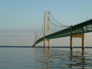
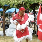
Today, The Father Marquette National Memorial Site , (museum was destroyed by fire and not rebuilt as by the State as of this date) overlooks the Big Mac bridge, paying respect to the past, while St. Ignace stays in step with the present. Various summer programs still are ongoing at the site. A new Rendezvous featuring a Native American Pow Wow and a celebration of French Traders and the fur trading business will be held the weekend before Labor Day each year. Check out the St. Ignace Video
The mysterious St. Helena Island lighthouse in the background
A short story by “Brother Jim Boynton” on an earlier life in our area
Among its popular present day attractions is the Straits Area Antique Auto Show and various other car festivals throughout the year, the big one is held the last weekend of June each year, a Native American Festival held in August, The Richard Crane Semi-tractor truck show that’s hotter than hot, that’s in September, snowmobile poker runs, winter festivals and much more.
St. Ignace is pleased to offer “The Little Bear”, hockey arena and convention center. This facility allows the Straits area to host conventions and activities and a central location in the downtown area. Check the Chamber web site for contact info.
Take time to stroll our downtown boardwalk, visit area shops in and around town, dine at one of our many restaurants, visit our museums and points of interest, picnic in one of our waterfront parks, or take a scenic drive to the sand dunes for a refreshing Lake Michigan plunge. Also discover the Great Waters Trail system, new to the EUP in 2006. And don’t forget to check with our Chamber of Commerce on all the available activities and great places to stay in this area.
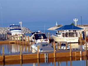
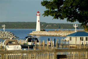
The new St. Ignace City Marina was voted “Best New Marina Of The Year” by the Detroit Free Press in 2004 and is located in the heart of the downtown area offering a convenient spot to stay and walk to shops, restaurants, libraries and more.
St. Ignace is a year-round community that welcomes people from all over the world. The natural beauty of the area, attractions and friendliness of our local community make it a great vacation area in addition to being a great place to live year round.
Looking for an itinerary, check out what the St. Ignace Chamber has come up with SUCHA DEAL (Thrifty Tourist Guide to St. Ignace), SaintIgnace.org
Financial Institutions
Prospect Financial (mortgage company) 858-800-4287 Local Branch-Russ Schlehuber
First National Bank of St. Ignace: 906-643-6800
Central Savings Bank: 906-643-9781
U.P. State Credit Union: 906-643-8138
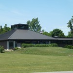
St. Ignace Library
St. Ignace Public Library
906-643-8318
Airports:
Mackinac County Airport: 906-906-643-7327 (town)
Pellston Regional Airport: 616-539-8441 (20 min)
Cherry Capital Airport: (Traverse City) (2 hours)231-947-2250
Mackinac Island Airport: 906-847-3231
Chippewa County Airport now services the EUP 906-495-5631
Straits Area Underwater Cave Discovered 2008
St. Ignace Museums
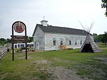
Museum of Ojibwa Culture and The Marquette Mission Park
The city-operated museum and park portray a vivid picture of life in the Straits of Mackinac over 300 years ago when Ojibwa, Huron, Odawa and French lifestyles met at this protected bay.
Museum exhibits show Ojibwa Indian culture and traditions, the French contact period, and the site’s rich archaeology.
Outdoor exhibits and a long house
Phone: 906-64-9161
500 N. State
334 N. State St.
St. Ignace, MI 49781
Operated by the Michilimackinac Historical Society
Phone: 906-643-6622
Currently only the gift shop is open and is seasonal while the new Heritage Center and Museum is being built across from the St. Ignace Marina. The current location is housing the collection of over 6,700 square feet of spectacular artifacts covering pre-contact French, English, and American periods. Historical military and Indian weapons collection. Historical movie “Black Robe” shown daily. Featuring the Dr. Benson collection. Gift store with antiques, collectibles and Native American Art and pieces.
Open daily-but seasonal only so call first for confirmaiton of current operating hours.
Downtown St. Ignace Historic Walking Tour
Stoll along the boardwalk and downtown area and learn the history of this historic town.
Michilimackinac Historical Society 2007 project
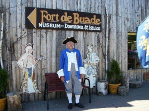
Booklets available at the St. Ignace Chamber of Commerce and Fort de Buade Museum
906-643-8717
Great read on the area (Cheryl’s Pic)
Straits Area Rendezvous and Pow Wow (check current schedule during COVID times)
at the Father Marquette National Park and Bridge Park. The weekend before Labor Day each year, for more information, contact the Chamber of Commerce.
There is also a Heritage Week that begins the week prior to the Rendezous….contact the Chamber of Fort deBuade Museum for more information.
Mackinac County’s unique Peninsula location situated between two Great Lakes continues to be a safe place to live and doesn’t see weather patterns such as hurricanes, floods and tornadoes as some other coastal areas do. High November winds and snowstorms seem to be the worst of it which sometimes will call for temporary bridge crossing delays. This county deals with snow removal with the best of them. Years of practice makes snow fall removal standard procedure.
St. Ignace, Michigan
| St. Ignace, Michigan | |
|---|---|
| — City — | |
|
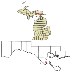
Location of St. Ignace, Michigan |
|
Location of St. Ignace, Michigan
Coordinates:  45°51′57″N 84°43′33″WCoordinates:
  45°51′57″N 84°43′33″WCountryUnited StatesStateMichiganCountyMackinacArea • Total2.7 sq mi (7.0 km2) • Land2.7 sq mi (7.0 km2) • Water0.0 sq mi (0.0 km2)Elevation587 ft (179 m)Population (2000) • Total2,678 • Density990.7/sq mi (382.5/km2)Time zoneEastern (EST) (UTC-5) • Summer (DST)EDT (UTC-4)FIPS code26-70840[1]GNIS feature ID1621477[2]
Saint Ignace, usually written as St. Ignace, is a city in the U.S. state of Michigan. As of the 2000 census, the city population was 2,678. It is the county seat of Mackinac County[3]. From the Lower Peninsula, St. Ignace is the gateway to the Upper Peninsula.
St. Ignace Township is located just to the north of the city, but is politically independent.
Located in Michigan’s Upper Peninsula, St. Ignace is at northern end of the Mackinac Bridge and Mackinaw City is to its south. The bridge connects the Lower and the Upper Peninsulas of Michigan.
History
The Museum of Ojibwa Culture at the site of a Wyandot (Huron) village, as well as the St. Ignace Mission; the mission is listed on the National Register of Historic Places.
St. Ignace is one of the oldest cities founded by Europeans in Michigan. Before French contact, Native Americans had inhabited the area for centuries. Historic peoples here were the Iroquoian-speakingWendat, whom the French called the Huron and, dominating the area by the 18th century, theAnishinaabe Ojibwe.
French explorer and priest Jacques Marquette founded the St. Ignace Mission on this site in 1671 and was buried there after his death.[4] He named it for St. Ignatius of Loyola, founder of the Jesuit religious order. (Ignace is the French version of Ignatius.) Jesuits worked at the missions to convert First Nations/Native Americans to Catholicism and share French culture.
While exploring the region on the ship Le Griffon with Louis Hennepin, La Salle reached St. Ignace on August 27, 1679. The Jesuits abandoned the mission in 1705. The Ojibwe, who came to dominate most of the territory of present-day Michigan in the 18th century among Native Americans, were allies of the French in the Seven Years War.
After the English victory in the Seven Years War, in 1763 they took over this territory of the former New France. After the victory of rebellious colonists in the American Revolutionary War, in 1783 the village became part of the new United States, as part of its territory.
A tombstone marks the grave of Father Marquette, next to the Museum of Ojibwayu Culture at the former site of St. Ignace Mission.
Originally an important fur trading site in early years of French colonization, St. Ignace declined in importance by the early 19th century with changes in ruling classes and the regional economy.
The Americans and British-Canadians operated a larger trading center at Sault Ste. Marie, on both sides of the northern border, until the decline of the fur trade in the 1830s. The fur trade was severely reduced before and during hostilities of the War of 1812, as the United States prohibited British traders from operating across the border, as had been their earlier practice. The Ojibwe allied with the British during the War of 1812.
In 1882, St. Ignace was given new life by the coming of the Detroit, Mackinac and Marquette Railroad, which connected the straits area to the major city of Detroit. It was incorporated as a village on February 23, 1882, and as a city in 1883.[4] Later the city has become a rural destination for heritage tourism.
Geography
According to the United States Census Bureau, the city has a total area of 3.7 square miles (9.6 km2), of which, 2.7 square miles (7.0 km2) of it is land and 0.37% is water.
Demographics
As of the census[1] of 2000, there were 2,678 people, 1,085 households, and 675 families residing in the city. The population density was 990.7 per square mile (383.0/km²). There were 1,232 housing units at an average density of 455.8 per square mile (176.2/km²). The racial makeup of the city was 71.81% White, 19.42% Native American, 0.56% Asian, 0.30% African American, 0.04% Pacific Islander, 0.19% from other races, and 7.69% from two or more races. Hispanic or Latino of any race were 0.90% of the population.
There were 1,085 households out of which 29.2% had children under the age of 18 living with them, 46.7% weremarried couples living together, 11.5% had a female householder with no husband present, and 37.7% were non-families. 31.6% of all households were made up of individuals and 15.0% had someone living alone who was 65 years of age or older. The average household size was 2.35 and the average family size was 2.96.
In the city the population was spread out with 23.2% under the age of 18, 8.6% from 18 to 24, 27.4% from 25 to 44, 22.7% from 45 to 64, and 18.1% who were 65 years of age or older. The median age was 39 years. For every 100 females there were 93.4 males. For every 100 females age 18 and over, there were 88.2 males.
The median income for a household in the city was $34,447, and the median income for a family was $45,893. Males had a median income of $29,813 versus $23,017 for females. The per capita income for the city was $17,340. About 6.0% of families and 9.0% of the population were below the poverty line, including 10.3% of those under age 18 and 9.5% of those age 65 or over.
Transportation
 I-75 routes over the Mackinac Bridge and through St. Ignace. Southbound I-75 takes drivers to the Lower Peninsula. Northbound the freeway heads toward Sault Ste. Marie and Canada.
 BL I-75 St. Ignace. Follows the route of old US 2.
 US 2 ends at St. Ignace and I-75.[5] Westbound, US 2 traverses a scenic stretch along Lake Michigan, toward Manistique and Escanaba.
 M-123 starts a few miles north of St. Ignace and heads north into Tahquamenon Falls State Park and eventually to Newberry.
 H-63, also known as Mackinac Trail,is a north-south route traveling along the former route of US-2 from just north of St. Ignace to Sault Ste. Marie.
- Three ferry companies (Arnold Transit Company, Shepler’s Ferry and Star Line Ferry) operate out of Saint Ignace, connecting tourists and commuters to Mackinac Island.
- The nearest airports with scheduled passenger service are in Chippewa County International Airport in Kinross (northeast of St. Ignace, adjacent to I-75) and Pellston Regional Airport[6] in theLower peninsula.
Local sights and events
St. Ignace contains many locations from where one can get a good look at the Mackinac Bridge.
Castle Rock, a geological limestone stack, is located three miles (5 km) north overlooking Lake Huron. Rabbit’s Back, a prominent promontory that also overlooks Lake Huron, is 4 miles (6.4 km) north.
Also featuring Kewadin Casinos – St. Ignace.
There are numerous civic events in St. Ignace.[7]
[edit]Images
[edit]Notes
- ^ a b “American FactFinder”. United States Census Bureau. Retrieved 2008-01-31.
- ^ “US Board on Geographic Names”. United States Geological Survey. 2007-10-25. Retrieved 2008-01-31.
- ^ “Find a County”. National Association of Counties. Retrieved 2011-06-07.
- ^ a b Sawyer, Alvah Littlefield (1911). A History of the Northern Peninsula of Michigan and Its People, p. 318. The Lewis Publishing Company
- ^ Highway ends, US 2.
- ^ Pellston Regional Airport
- ^ St. Ignace’s Website
Chamber of Commerce
[email protected]


